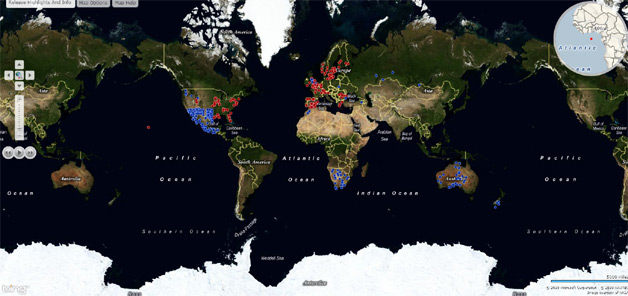
Microsoft is rolling out the largest imagery update to Bing Maps to date, adding 6.7 million square kilometers of new imagery, a representative for Bing tells WebProNews.
The update includes new aerial imagery for the Russian Federation, Australia, Mexico and most places in the US where there is existing black and white imagery. "There is also a notable addition of Bird’s Eye Imagery for Sweden," the rep says.

Here’s a list as mentioned on the Bing Maps Blog:
Aerial
Australia 524,645 sq. km.
Botswana 61,433 sq. km.
Estonia 618 sq. km.
Hungary 3,369 sq. km.
Mexico 236,624 sq. km.
Morocco 13,303 sq. km.
Namibia 72,162 sq. km.
New Zealand 14,987 sq. km.
Poland 6,254 sq. km.
Romania 3,695 sq. km.
Russian Federation 553,244 sq. km.
South Africa 123,138 sq. km.
Turkey 16,148 sq. km.
United Kingdom 15,221 sq. km.
United States 4,961,758 sq. km.
Oblique (Bird’s Eye)
Austria 238 sq. km.
Belgium 898 sq. km.
Denmark 718 sq. km.
Finland 1,634 sq. km.
France 2,001 sq. km.
Greece 931 sq. km.
Ireland 1,340 sq. km.
Netherlands 1,709 sq. km.
Norway 2,425 sq. km.
Portugal 2,184 sq. km.
Romania 1,534 sq. km.
Spain 5,143 sq. km.
Sweden 6,747 sq. km.
Switzerland 424 sq. km.
United Kingdom 13,094 sq. km.
United States 56,007 sq. km.
Last month Bing had pushed out its biggest imagery update to that point, but as Chris Pendleton says on the blog, this one blows that record out of the water.
Visuals can be seen via the


 WebProNews is an iEntry Publication